Catalog Archive
Auction 134, Lot 574

"Nieuwe en Seer nette Caart van de Baay en Stadt Gibraltar, Geteekent door den Wel Ede: Hr: H. Leysnslager…", Keulen, Johannes van
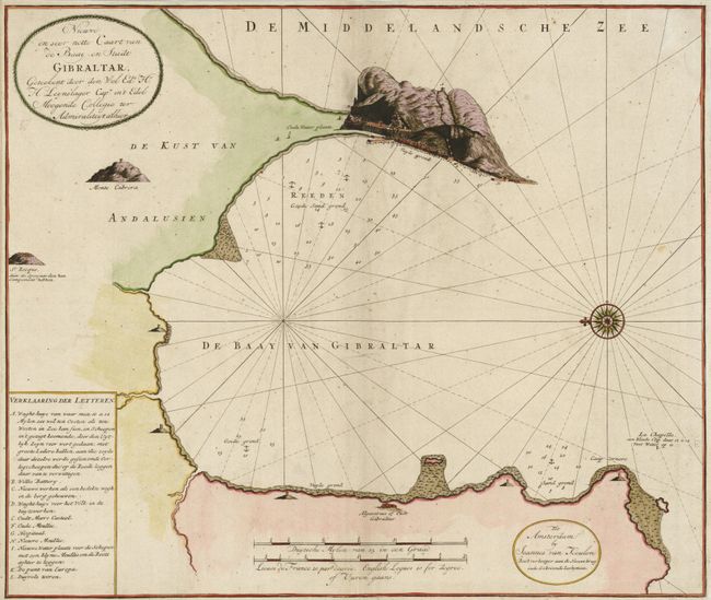
Subject: Gibraltar

Period: 1735 (circa)

Publication:

Color: Hand Color

Size:
23.5 x 19.8 inches
59.7 x 50.3 cm
Download High Resolution Image
(or just click on image to launch the Zoom viewer)

This rare Dutch sea chart of the bay of Gibraltar is from a contemporary survey by Captain Hendrik Lynslager who spent much of his career in the western Mediterranean. The chart is oriented with north to the left with a large compass rose and includes a key to eleven points of interest. It provides a detailed profile of Gibraltar and the bay including anchorages, soundings, shoals, and sand bars.

References:

Condition: B+

Narrow, but adequate margins with some soil and extraneous creasing along centerfold where there are a couple of minor repairs.

Estimate: $550 - $650

Unsold

Closed on 12/1/2010

Archived