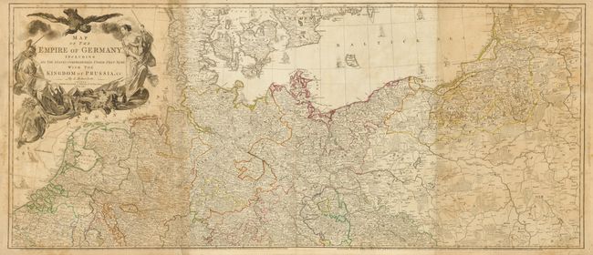
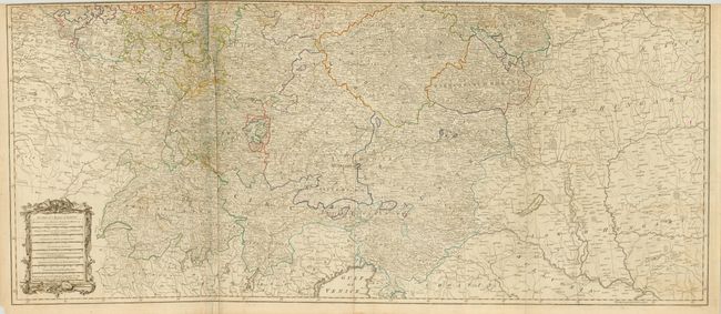
Subject: Central Europe, Germany
Period: 1794 (dated)
Publication: General Atlas
Color: Hand Color
Size:
47 x 40.5 inches
119.4 x 102.9 cm
This large, well-detailed map covers the German Empire, which at the time extended from the Baltic Sea to the Gulf of Venice. It includes Germany, Austria, Czech Republic, Slovenia, Poland, Lithuania, Switzerland, the Netherlands, Belgium and most of Denmark. There is an extraordinary level of detail throughout, noting roadways, towns, castles, monasteries, forests, swamps, rivers, cities and mountains. An elaborate allegorical title cartouche in the upper left quadrant depicts the German double-headed eagle overlooking two warrior maidens who have just banished Medusa. This is the 1794 updated edition of a map originally published in 1759. It was engraved by Thomas Kitchin and published by Laurie and Whittle. Printed on four sheets and joined as two horizontal sheets, as issued.
References:
Condition: B
Original outline color with some minor foxing. Two sections are darker toned that the others and there are some creases along a couple of folds. There is a short repaired tear at the bottom left of the top sheet that would be covers if the sheets were joined.