Subject: Paris, France
Period: 1705 (circa)
Publication: Traite de la Police
Color: Hand Color
Size:
20.8 x 17.2 inches
52.8 x 43.7 cm
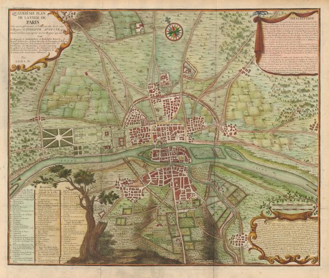
This is the fourth map in a series of eight that illustrates the growth of the city of Paris. This edition shows the city during the reign of Philip II Augustus at the end of the 12th century. The city on both sides of the Seine is enclosed in a stone wall, now known as the Wall of Philip Augustus, built to protect the city during the king's absence during the Third Crusade. Philip Augustus also began construction on the Palais du Louvre, shown here as Le Grande Chatelet, as well as paving streets and establishing a covered market at Les Halles. There was considerable growth on the south side on the river during this period. The cartouches provide a detailed description of the changes and there is an extensive key to the map. Designed and engraved by A. Coquart.
References:
Condition: A
Issued folded, now flattened with tissue reinforced fold intersections. There is some minor toning and foxing in the blank margins.