Subject: Low Countries
Period: 1735-1850 (circa)
Publication:
Color: Hand Color
Nice pair of decorative maps of the Low Countries that span the 18th and 19th centuries.
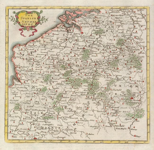
1) The Spanish Netherlands is a wonderful, small map by Herman Moll, circa 1735 showing Belgium with Calais on the coast across to Limbourg in the east. Paris is at the southernmost point of the map, which is roughly centered on Namur. The map is adorned with a delicate floral cartouche. (Map is 7.3 x 7" on a sheet 8 x 12" with English text). Fine. (A+)
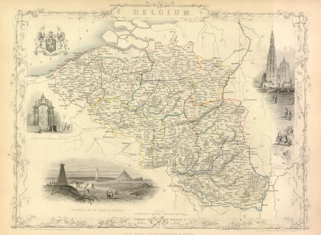
2) Belgium is a decorative and finely engraved map with vignettes of the Antwerp Cathedral, Monuments on the Plains of Waterloo, Altar of St. Gudule, Brussels, and the royal coat of arms flanked by two ferocious lions. There is nice detail of roads, canals, and towns. Surrounded by a delicately engraved and decorative border by J. Marchant and J. B. Allen, who also did the vignettes. The map was engraved by J. Rapkin, and published by John Tallis, circa 1850. (13 x 9.7") Adequate margins outside of the border and imprint, always a concern with these maps. Map image is fine with a little toning at edges of margins. (A)
References:
Condition:
See individual descriptions.