Subject: Ancient World
Period: 1540 (circa)
Publication: Cosmographey
Color: Hand Color
Size:
13.6 x 10 inches
34.5 x 25.4 cm
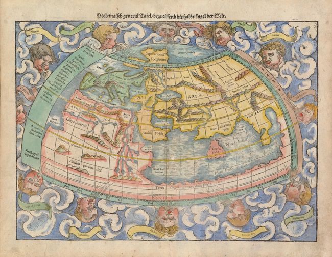
This woodcut, Ptolemaic world map is surrounded by clouds and eleven wind heads (with their names shown in banners). The continents are oddly shaped and all connected by a great southern continent Terra incognito secundum Ptolemaeum, which land locks the Indian Ocean. There is a very large Taprobana (modern day Sri Lanka) in the Indian Ocean, and the Indian subcontinent is severely truncated. Only the northern part of Africa is shown with the Nile originating in a series of lakes in a large mountain range. The crack in the woodblock is evident on the right side of the map. Latin text and a lively woodcut on verso.
References: Shirley #76.
Condition: B+
Some bleed through of color on verso, else very good.