Subject: World
Period: 1851 (circa)
Publication: The Illustrated Atlas…
Color: Hand Color
Size:
13.8 x 10.3 inches
35.1 x 26.2 cm
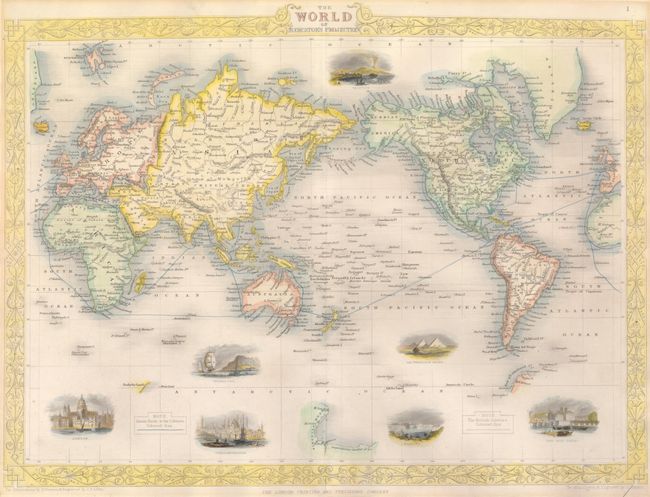
This is a very handsome steel engraved world map that was produced from the same plate used to celebrate the explorations by Captain James Cook. This issue has seven vignettes rather than only one vignette of Cook's ship Endeavour. The beautifully rendered vignettes on this issue show important places and cities of the world including London, Constantinople, Niagara, the Pyramids of Ghizah, Port Neuf in Paris, Gibraltar, and Vesuvius. In the seas the "Steam Routes to the Colonies" are shown in color. The map was drawn and engraved by J. Rapkin, the illustrations are by H. Warren, engraved by J.B. Allen. Published by the London Printing and Publishing Company.
References:
Condition: A+
Map is fine with strong impression and period-correct hand coloring. Margins are fully outside the border, always an issue with these maps. In upper blank margin is an old mat board burn, still fine.