Subject: England
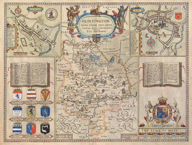
Period: 1610 (dated)
Publication: Theatre of the Empire of Great Britaine
Color: Hand Color
Size:
20 x 15 inches
50.8 x 38.1 cm
Superb map of Huntingtonshire with inset Huntington and Ely city plans, information on Ely along with family history and nine coats of arms. Distance scales in the insets are measured by 'pases.' A beautiful example of the British Royal coat of arms is prominently shown above the scale of miles. Speed's county maps were finely engraved by Jodocus Hondius, one of the preeminent engravers of the period; this one bearing his imprint at bottom right. Also with the imprint of George Humbell (sic). English text on verso. John Speed is best known for this important atlas of Great Britain, which is considered the finest achievement in British map-making. Speed assembled the information for this atlas based on the work of Christopher Saxton and John Norden, updated with new information. He also introduced innovations of his own including the inclusion of town plans, indications of the hundreds, county boundaries and the coats of arms of local Dukes and Earls.
References:
Condition: B
Strong old hand coloring and very nice impression. Margins close as issued. A little damage with small loss at middle of centerfold with old paper repair on verso.