Catalog Archive
Auction 134, Lot 384

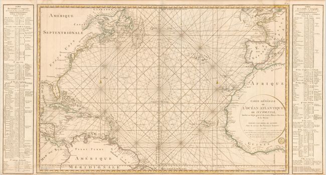
"Carte Generale de l'Ocean Atlantique ou Occidental…", Depot de la Marine

Subject: North Atlantic

Period: 1792 (dated)

Publication:

Color: Hand Color

Size:
45.5 x 24 inches
115.6 x 61 cm
Download High Resolution Image
(or just click on image to launch the Zoom viewer)

This large-scale chart of the North Atlantic shows the northeast coast of North America, the West Indies, Central America and the northern coast of South America. Opposite it covers the coastlines of Europe and northwestern Africa. The center of the chart is crossed with rhumb lines on 17 centers, radiating across the Atlantic with the prime meridian running just west of the Canary Islands. Tables of latitude and longitude flank the map. The map itself measures 36 x 24". This is the 5th edition with corrections to 1792.

References:

Condition: B+

There is a light damp stain at bottom, else very good.

Estimate: $375 - $450

Sold for: $275

Closed on 12/1/2010

Archived