Subject: World
Period: 1750 (published)
Publication: Voyage Autour du Monde
Color: Black & White
Size:
15.8 x 9 inches
40.1 x 22.9 cm
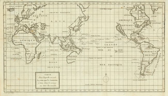
This is a map of Anson's voyage around the world from the French edition of the voyage published in 1750. It was engraved by Lattre and is identical to the English edition "A Chart Shewing the Track of the Centurion Round the World…" except for the French place names and title. The track of the voyage and California represented as an island remain the most prominent features of the map.
A world map to accompany an account of Commodore Anson's expedition to the South Seas to harass the Spanish bases but, more importantly, plunder their shipping. From a military viewpoint the expedition was a disaster: back-stabbing in the Admiralty meant that Anson was equipped with poor ships and received a regiment of Chelsea Pensioners rather than the promised Marines. One had served at the Battle of the Boyne sixty years earlier! Half had deserted before they reached the docks at Portsmouth. An atrocious voyage meant that the fleet arrived in the Pacific in very poor shape, but a stroke of luck presented them with a Spanish galleon laden with silver. On their return to London, thirty-two wagons were needed to transfer it to the Tower of London.
References:
Condition: B+
Folding as issued with a large text-based watermark. There is some faint offsetting and a few very small spots. It is clean with a sharp strike. The right margin has been added to the neat line with period-correct paper and a little facsimile to the neatline, the balance of the map is very good.