Subject: Argentina
Period: 1753-57
Publication: Histoire Generale des Voyages
Color: Hand Color
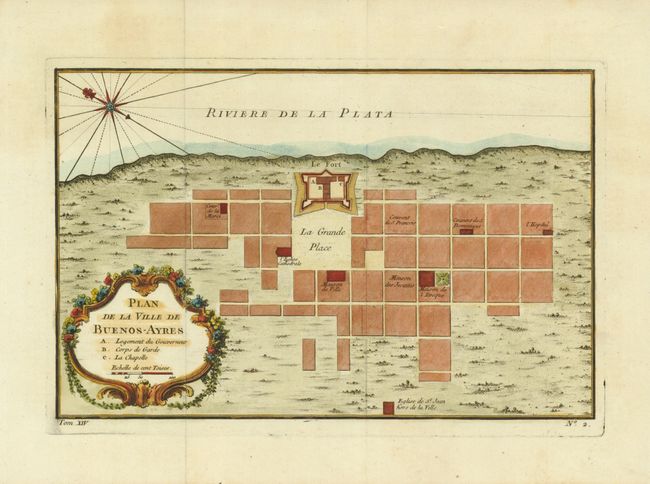
1) Plan de la Ville de Buenos-Ayres, circa 1757, (10.8 x 7"). This early plan of Buenos Aires is laid out in blocks with unnamed streets. A few important buildings are named and the fort is prominently shown on the coast with its ramparts well delineated. Embellished with large compass in the bay and a rococo-style title cartouche that incorporates a distance scale.
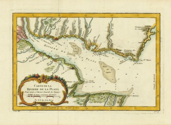
2) Carte de la Riviere de la Plata, circa 1757, (11.2 x 7.4"). This chart details the mouth of the Rio de la Plata with Buenos Aires shown on a grid plan. The bay is marked with soundings, anchorages, and shoals. Decorative rococo-style title cartouche with distance scale.
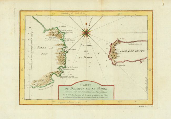
3) Carte du Detroit de le Maire, dressee sur les Journaux des Navigateurs…, 1753, (10.8 x 7.6"). This chart illustrates this important passage between the Atlantic and Pacific oceans. Jacob Le Maire and Willem Schouten discovered the strait in 1616, which was a much less treacherous route than the Strait of Magellan, and opening up a new trade route for the Dutch. The map is adorned with a fine compass rose.
References:
Condition: A+