Subject: Lesser Antilles, St. Lucia
Period: 1763 (dated)
Publication: Hydrographie Francoise…
Color: Hand Color
Size:
34.2 x 22 inches
86.9 x 55.9 cm
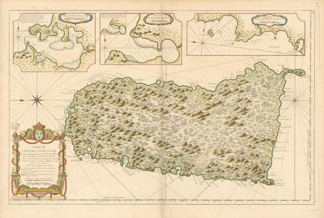
First edition of this handsome, large-scale map of St. Lucia . Above the map are three insets; Plan du Port du Carenage, Plan de Cul de Sac des Roseaux, and Mouillages du Grand Islet et du Choc, each with soundings and their own decorative cartouches. The large compass rose orients the map with north to the right. The main map is filled with charming pictorial representations of plantations, roads, trees, and mountains. The coastal notes include anchorages as well as the location of an ancient French fort. The map is decorated with an ornate title cartouche incorporating the royal coat of arm.
References: Tooley (MC#81) #6, plt. 1.
Condition: A
Fine impression printed on sturdy paper. Very faintly toned along the centerfold, overall still very good.