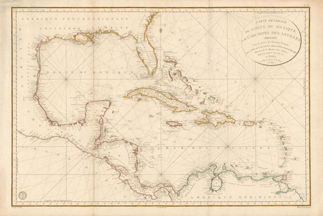
Subject: Gulf of Mexico and Caribbean
Period: 1807 (dated)
Publication:
Color: Hand Color
Size:
34.3 x 23 inches
87.1 x 58.4 cm
This scarce, large-scale chart covers the Gulf of Mexico, Central America, the West Indies and the north coastline of South America. Typical of nautical charts, the detail is confined to the coastline and includes place names, soundings, navigational hazards, banks, and shoals. This map was commissioned during the Napoleonic Wars when French efforts were focused mainly in Europe and French colonial possession were confined to a few islands in the Lesser Antilles and French Guiana. Seal of the Depot de la Marine at bottom left and Prix Trois Francs below neatline at right.
References:
Condition: A
Overall very good with original outline color and very faint toning along one fold.