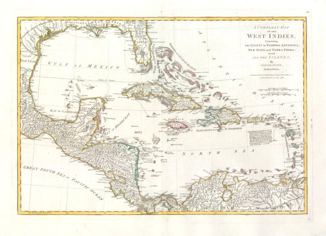
Subject: Gulf of Mexico and Caribbean
Period: 1786 (dated)
Publication: West-India Atlas
Color: Hand Color
Size:
17.5 x 12 inches
44.5 x 30.5 cm
This scarce map was drawn by Samuel Dunn, Mathematician … Printed for Robt. Sayer, No. 53, Fleet Street - as the Act directs, 10 June, 1786. It shows information on coastal features and limited interior detail including watershed and larger towns. It extends to include an interesting depiction of Florida and south to show the northern portion of South America. The area of today's Belize is labeled Logwood Cutters referring to the British cutting of logwood, greatly valued in Europe as the principal dyestuff for the expanding wool industry. By the 1770s, mahogany replaced logwood as the main export from Belize. The map carries a notation explaining how the Windward and Leeward Islands came to be known. This is a later edition of the map which appeared in the American Military Pocket Atlas with the same title. Page 41 is at upper and lower right corners just outside the neatline.
References: Sellers & Van Ee #1697.
Condition: A+
An exceptionally beautiful example with fine coloring and dark impression on a sheet of thick hand laid paper with wide margins. Large fleur-de-lis watermark. A few tiny pin holes visible when held to light, still fine.