Subject: Washington
Period: 1879 (dated)
Publication: Sen. Doc. #120, 46th Congress
Color: Black & White
Size:
21 x 16 inches
53.3 x 40.6 cm
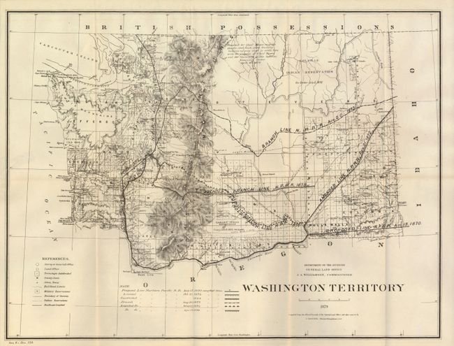
This map is from the annual report of the GLO and shows the entire territory. It provides information on the status of surveys, various Indian treaties, and the state of development and settlement. The maps main thrust is the delineation of railroads throughout the territory. A note uses different line types to indicate the various lines of the Northern Pacific Railroad. Indicates proposed lines, constructed lines, and branch lines, each with their date. The legend identifies townships subdivided, county seats, railroad limits, Indian and military reservations, and more. An interesting notation west of the Colville Indian Reservation states "Reserved for Chief Moses and his people, and such other friendly Indians as may elect to settle here with the Consent of Chief Moses and the Secretary of the Interior."
References:
Condition: B
Folding as issued. The map image is clean with no flaws except a 1" tear at right edge closed on verso with cello tape. Map presents from front as near fine.