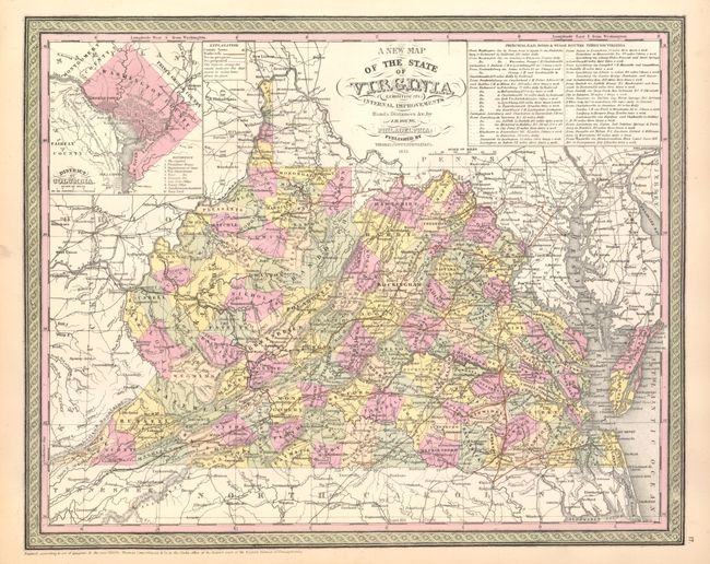
Subject: Virginia
Period: 1855 (dated)
Publication: New Universal Atlas
Color: Hand Color
Size:
15.7 x 12.5 inches
39.9 x 31.8 cm
This attractive map has the imprint of Thomas, Cowperthwaite and is filled with detail of the counties, cities, roads and railways. Delineates and names counties with engraved line and hand coloring. At top right is an inset with the detailed explanation of the "Principal Rail Road & Stage Routes through Virginia." A second inset is a city plan of Washington D.C. The map is drawn on a scale of 30 miles per inch. The legend uses different lines and color to differentiate between operational railroads, those in progress and those planned. Fancy titling and decorative border. The Thomas, Cowperthwaite company purchased the copyright to Mitchell's maps in 1850, the date of this first issue by the new firm.
References: Ristow pp. 131-133.
Condition: A+
Fine example with original color and strong impression.