Subject: Pennsylvania
Period: 1796 (published)
Publication: The American Atlas
Color: Black & White
Size:
17.8 x 12.6 inches
45.2 x 32 cm
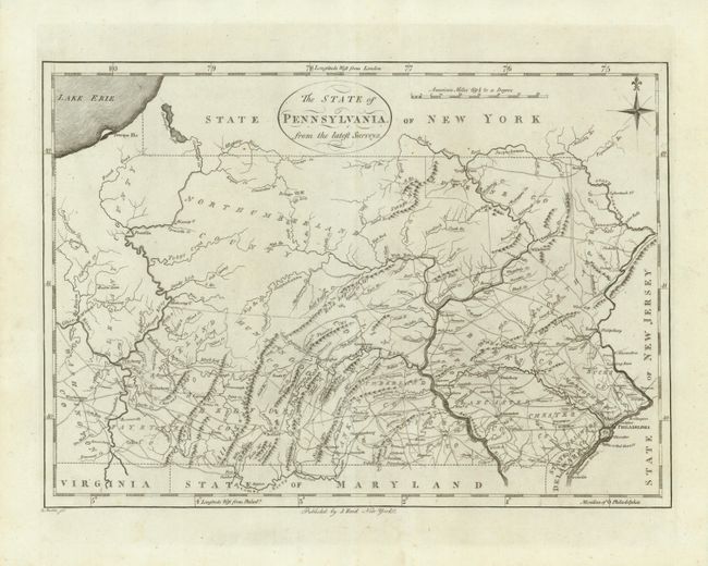
This map is the first state of Reid's early map of Pennsylvania which was based on Reiding Howell's map of 1792, which was the first detailed map to correctly show the boundaries. On this map the new New York - Pennsylvania boundary has been used with the old one erased from the plate. Allegany is listed for both the County and River. The West branch of the Schuylkill, Little Schuylkill, and Potomac rivers are shown. The detail includes topography, towns, donation lands, counties and townships, as well as remarkable network of early roads. This map was also published in Winterbotham's America.
References: Wheat & Brun #450.
Condition: A
Near flawless example on bright, thick paper with wide margins and nice impression.