Subject: Boston, Massachusetts
Period: 1870 (dated)
Publication:
Color: Hand Color
Size:
34.5 x 25.4 inches
87.6 x 64.5 cm
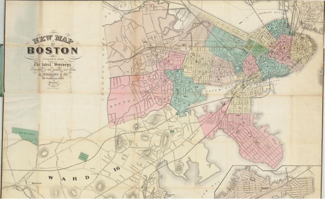
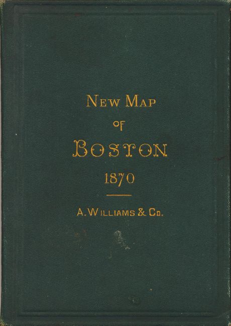
This uncommon pocket map is printed on fine banknote-style paper and is a Boston production. It was "Published at the Boston Map Store" and lithographed by J. Mayer & Co., 4 State Street. The map shows the vicinity around Boston, extending to the west to Lower Mills, Port Norfolk and Mattapan. Portions of the city are colored pink, green, yellow and blue but no legend suggests any purpose to the coloring scheme. Reclamation has occurred in the north along Beacon Street, but the South Bay is still in a large configuration. Delineates and names numerous railroads and most streets. Large inset at lower right shows East Boston and indicates the areas of planned reclamation. Fancy lettering in title with flourishes. Folds into green cloth boards (4 x 6") with stamped gilt title on front. Original paper label inside front advertising the "Maps, Atlases and Globes" available from Williams & Company.
References:
Condition: B+
The map is generally clean and bright, but with a little occasional fold toning that is heavier on one fold line. A few fold intersection splits as commonly found on pocket maps from this period.