Subject: Florida
Period: 1864 (dated)
Publication:
Color: Printed Color
Size:
23 x 16.6 inches
58.4 x 42.2 cm
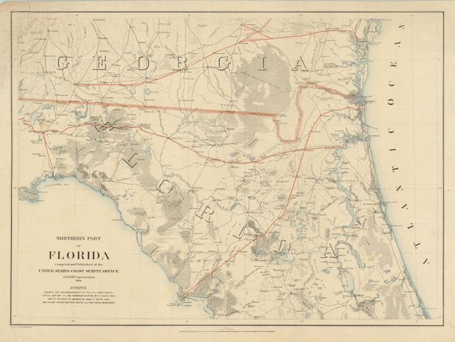
This Civil War period map looks more like a topographical map than a publication from the Coast Survey. It was probably printed for limited distribution as there are no prior sales records that we can locate. The interior is fully mapped with towns and villages noted, roads, railroads, swamps, lakes and rivers. The map covers the portion from St. James Island and Tallahassee to the west and south to below the Cedar Keys. Counties are not delineated but the map names many towns and forts including Monticello, Black Dirt, Camp Izard, White Springs, Volusia, Welaka, St. Augustine, Jacksonville, Collin's PO, and the forts of Andrews, Barker, King, Gates and Call, to name a few. Also locates steam mills, Indian mounds, springs and ferries. Extends about fifty miles into Georgia with the same degree of detail. Railroads are named and boldly delineated with red overprinting. Scale is 10 miles per inch.
References:
Condition: B
Good color and impression with original margins. One corner cleanly torn off rejoined with tape repair on verso and a few other marginal tears, one into border, all closed on verso. Small stain above Tallahassee.