Subject: Florida
Period: 1856-57 (dated)
Publication:
Color: Black & White
The Office of Coast Survey is the oldest U.S. scientific organization, dating from 1807 when Congress directed that a "survey of the coast" be carried out. By 1836, it was called the U.S. Coast Survey and in 1878, the name was changed to the U.S. Coast and Geodetic Survey. Today the Office of Coast Survey is a division of the National Oceanic and Atmospheric Administration NOAA.
The survey teams, composed of civilians as well as Army and Naval officers, charted the nation's waterways and produced a wide array of reports, survey charts, hydrographic studies of tides and currents, astronomical studies and observations, and coastal pilots. These charts are an important record of the changing nature of the nation's coastlines. In additional to coastal charts, the U.S. Coast and Geodetic Survey produced land sketches, Civil War battle maps, and the early aeronautical charts.
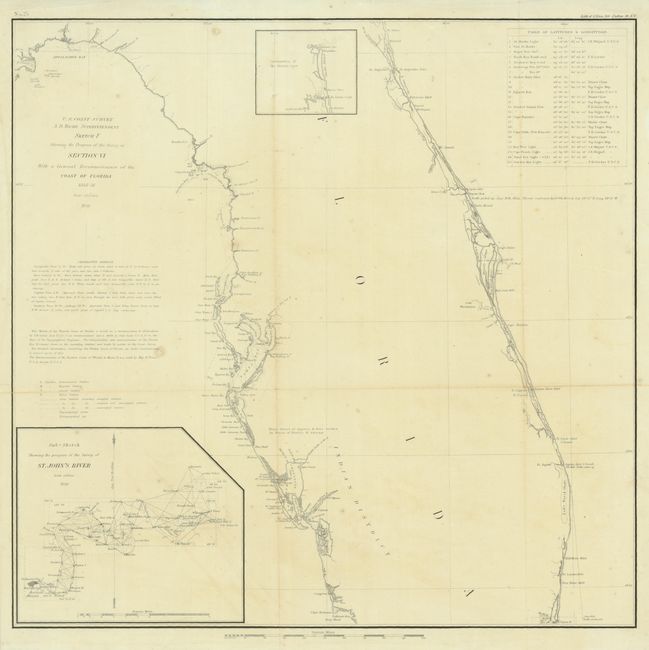
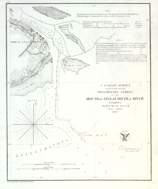
First map (16.4 x 16") shows most of the Florida peninsula with insets of St. John's River from Jacksonville to the mouth, and a smaller inset showing the continuation of the Atlantic coast up to Amelia Island. Second map (8.5 x 10.4") depicts the town of Apalachicola at the mouth of the Apalachicola River showing the narrow navigation channel.
References:
Condition:
Both issued folded, now flattened. First lightly toned with a minor tear at lower right, just entering the map, closed with archival tape (B+). Second fine with some minor soft creases (A+).