Subject: District of Columbia
Period: 1836-1850 (dated)
Publication: A New Universal Atlas
Color: Hand Color
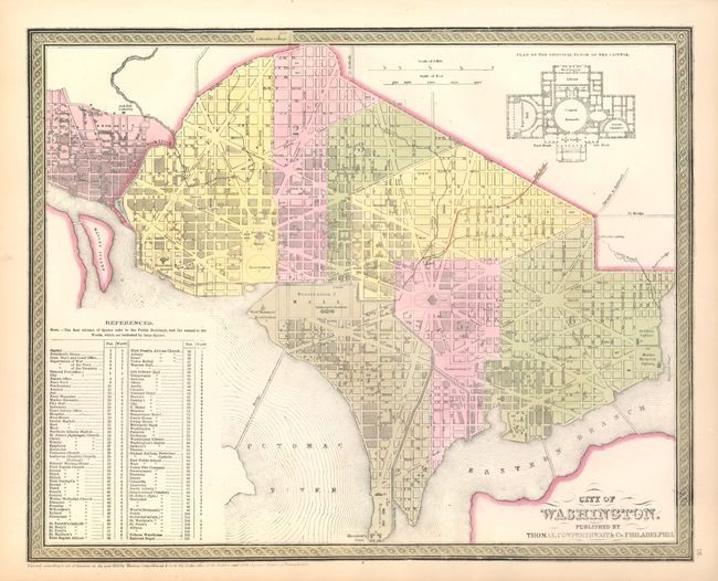
The first city plan was published circa 1850 by Thomas, Cowperthwait & Co. in Mitchell's New Universal Atlas. (15.5 x 12.5") It is a detailed plan of the Capitol as it appeared in the early 1850's with an architectural plan of the principle floor of the Capitol building at upper right. Large References table locates 107 important buildings including embassies, churches, government and military facilities, galleries, breweries, etc. Surrounded by the signature banded border. Fine example (A+).
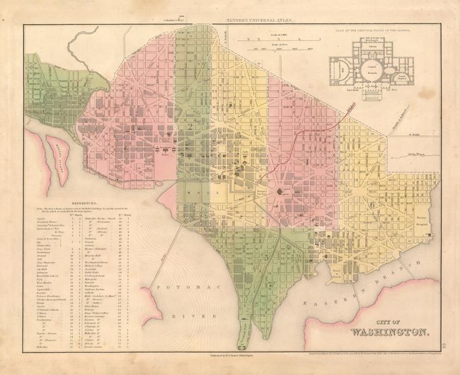
The second map shares the same title. It was produced by Henry S. Tanner, 1836, (14.7 x 11.5"). For his new atlas, Tanner employed eight different engravers, but 18 of the maps bear no engraver credit, including this map. The lineage to the later Mitchell map above is clearly evident. Tanner's imprint, dated 1836, is below the lower neatline. Ristow says Tanner had probably completed most of the work on this atlas before he sold the rights to Carey & Hart who published the first edition, but most of the maps retained Tanner's imprint. On sound paper with original hand coloring and full margins. One spot at upper left in blank area (B+).
References: Ristow pp.200-202 & 131.
Condition:
See description.