Subject: California
Period: 1849 (dated)
Publication: Senate Doc. #47, 31st Congress 1st Session
Color: Black & White
Size:
19.5 x 21 inches
49.5 x 53.3 cm
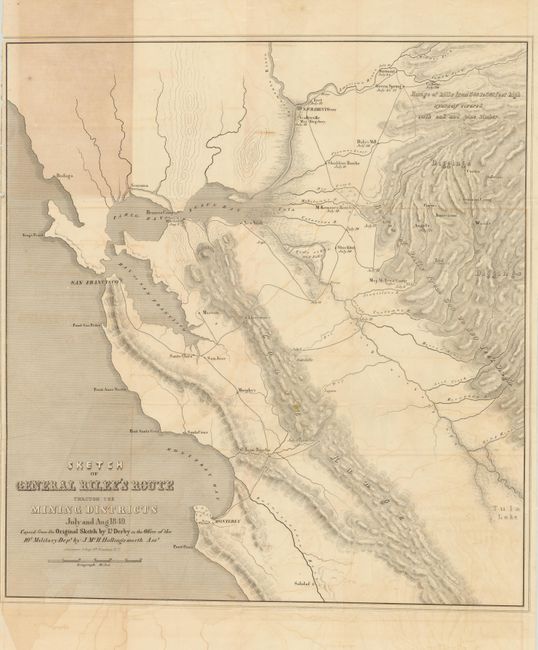
This important and early map of the California Gold Rush was made from Lt. Derby's original sketch by J. Mc. H. Hollingsworth in the office of the 10th Military Dept. It is historically important, not only for its depiction of Gen. Riley's route, but because it names, for the first time, certain actual mining camps in the middle Sierra foothills; Mormon Island (misspelled Mormont), Coloma (mislabeled Colluma), Curtis, Sullivan's, Corons, Jamestown, Woods and Sonora. The entire route of the Riley party is noted, with the dates of their visits to the various camps, and covers the region from Monterrey Bay, north to Sacramento and east to the gold diggings.
References: Wheat (Gold) #79; Wagner & Camp #179 b: 1 & 2.
Condition: B+
Folding as issued with nice impression on sound paper with original margins. Some offsetting and one panel with light toning where bound in book . Left margin is close with binding trim just to neatline at upper left.