Subject: Northwestern United States
Period: 1864 (circa)
Publication: Illustrated Family Atlas
Color: Hand Color
Size:
16 x 12.6 inches
40.6 x 32 cm
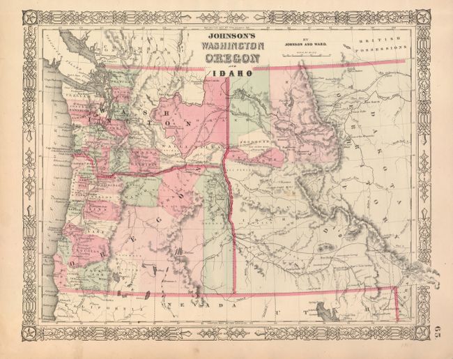
A nice hand colored map of the northwest, with an enlarged Idaho Territory incorporating present-day western Montana. Gold discoveries in Clearwater Country, Idaho, in September 1860 led to an influx of thousand of miners into the region. Idaho was organized as a territory in July 1863 and Montana was separated as a territory in May 1864, thus this map was issued for only a short period of time. The area of the Solomon River and the New Pierce mines are shown as are other mining centers. Fort Boise is shown on the Oregon & Idaho border.
References:
Condition: A
Near fine example with only a tiny spot near the Salmon River Mines in Idaho. In the lower margin a short tear has been closed on verso.