Subject: Midwestern United States, Minnesota & Dakota
Period: 1861-1870 (circa)
Publication:
Color: Hand Color
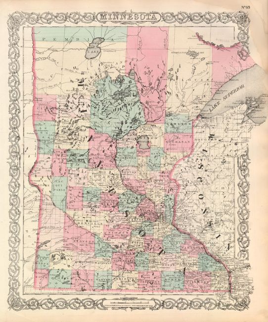
1) G.W. & C.B. Colton, circa 1870, New York, hand colored, 13" x 16". Very densely engraved map of the state with the correct statehood boundaries. It is very detailed with identification of regions, important cities, rivers, lakes, mountain ranges, and railroad lines. Development is still limited to the lower half of the state and the area around the Duluth area. A network of railroads and roads fill the lower half with one running diagonally to Breckenridge and continuing westward across the North Red River or the Sioux Wood River. Another extends to Duluth. This edition is surrounded by Colton's familiar scroll-work decorative borders with oval cartouches incorporated at top and bottom for the title and publishers imprint. Light stain in upper right margin, image is fine. (A)
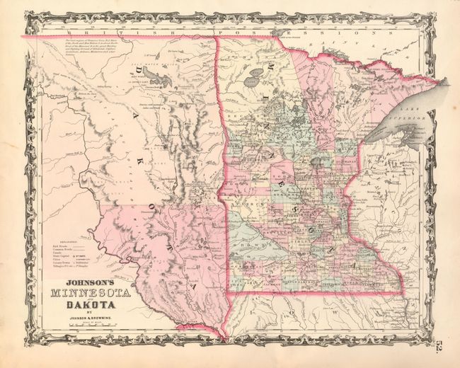
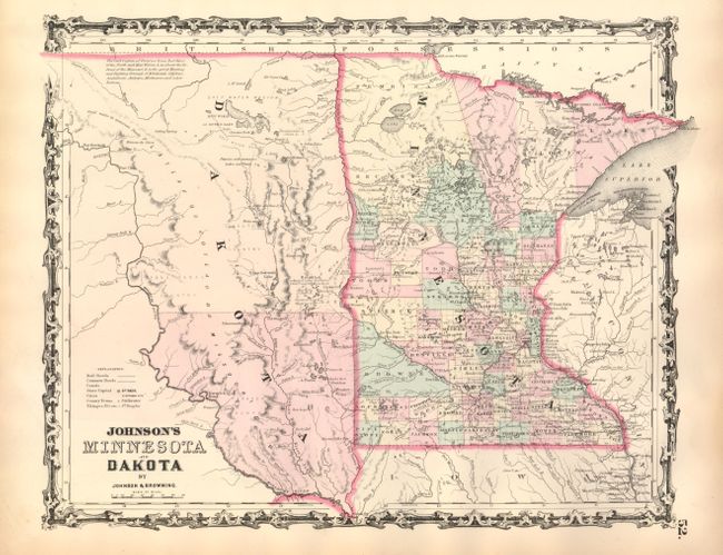
2 & 3) Johnson & Browning, New York, 1861, hand colored, 16" x 12.4". The newly formed Dakota Territory is a huge unorganized area with its western boundary just beyond the Missouri River. Interesting notation locates vast prairies said to be "the great Hunting and Fighting Ground of Dakotah, Odjebwe, Assiniboin, Arikara, Minitarree and other Nations." The proposed Northern route of the Pacific Railroad is shown crossing the Dakota wilderness. Good detail throughout Minnesota, whose county development is already well developed. Handsome maps with attractive scroll borders. Both are beautiful examples with fine image. (A)
References:
Condition:
See individual descriptions.