Catalog Archive
Auction 134, Lot 199

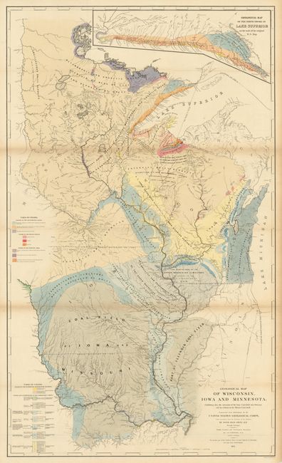
"Geological Map of Wisconsin, Iowa and Minnesota: Exhibiting, also the extension of the Iowa Coal-field into Missouri, and its relation to the Illinois Coal-field", Owen, David Dale

Subject: Midwestern United States, Wisconsin, Iowa, Minnesota

Period: 1851 (dated)

Publication:

Color: Hand Color

Size:
26 x 43.8 inches
66 x 111.3 cm
Download High Resolution Image
(or just click on image to launch the Zoom viewer)

This detailed and colorful geological map is from Owen's report, submitted in 1851 and published in 1852. Assisted by J. G. Norwood, C. Whittlesey and other noted scientists, Owen's report made major contributions in several fields. The map itself shows an abundance of geological formations via hand coloring. It also shows the Iowa coal-field extending into northern Missouri and part of the Illinois coal-field. Inset "Geological Map of the North Shore of Lake Superior" is drawn on the scale of the original manuscript map. There is excellent detail of watershed and lakes throughout. A very graphic and well colored map.

References:

Condition: A

This is a very nice example of this large folding map that features fine hand coloring, bright paper and dark impression. Just a trace of some fold toning, still very good for a map of this size.

Estimate: $200 - $250

Sold for: $150

Closed on 12/1/2010

Archived