Subject: Southern United States - Kentucky and Tennessee
Period: 1795 (dated)
Publication: American Atlas
Color: Black & White
Size:
17.4 x 14.6 inches
44.2 x 37.1 cm
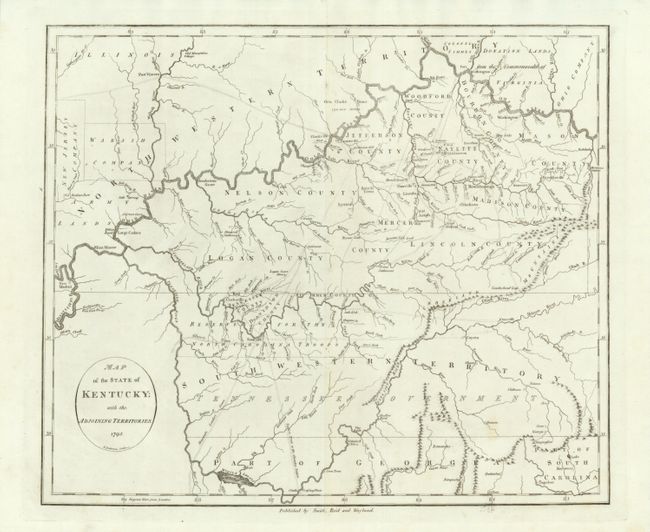
This is a scarce and significant map depicting the entire state of Kentucky, most of Tennessee (labeled as South Western Territory), and the northern part of Georgia. The map was issued only three years after statehood for Kentucky and just before Tennessee became a state. The map was copied from John Russell's map of the previous year and provided the best information available at the time for the trans-Appalachian frontier. Seven subdivisions of the original three counties are shown and pioneer roads (called traces) are shown throughout both Kentucky and Tennessee. Towns such as Lexington, Louisville, Nashville, Knoxville, Boonsborough, and even mills and orchards are denoted. Of particular interest are the depictions of the planned, but never built, utopian settlements of Somerset and Franklinville. Several Bounty Land Grants are shown.
This example is the first state with the imprint of Smith, Reid and Wayland below the lower neatline. The map was published in William Winterbotham's Atlas and in early editions of Reid's The American Atlas.
References: Wheat & Brun #646.
Condition: A+
A remarkable example of this desirable map. Crisp, early impression on clean paper with original margins.