Catalog Archive
Auction 134, Lot 174

"Carte de la Virginie et du Maryland, ou de la Baie de Chesapeack et Pays Voisins…", Bellin, Jacques Nicolas

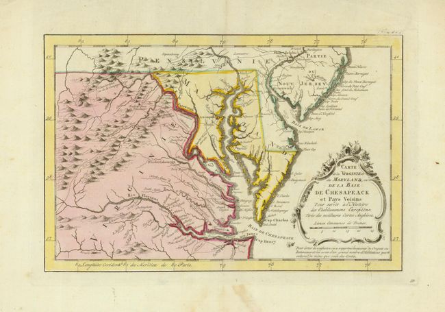
Subject: Colonial Mid-Atlantic

Period: 1773 (circa)

Publication: Raynal's Atlas Portatiff…

Color: Hand Color

Size:
11.2 x 7.4 inches
28.4 x 18.8 cm
Download High Resolution Image
(or just click on image to launch the Zoom viewer)

Finely engraved colonial map that covers most of Virginia, Maryland, Delaware with a bit of Pennsylvania and New Jersey. The interior is fully engraved with mountains and great detail along the rivers. An early network of trails and wagon roads stretches as far west as Frederic Town ou Winchester and north to Philadelphia. A delicate rococo-style title cartouche adorns the map.

References:

Condition: A

Strong impression with original color and a small paper abrasion and slight stain in bottom blank margin.

Estimate: $325 - $400

Sold for: $375

Closed on 12/1/2010

Archived