Subject: Colonial New England and Mid Atlantic
Period: 1684 (circa)
Publication:
Color: Hand Color
Size:
21.8 x 18.4 inches
55.4 x 46.7 cm
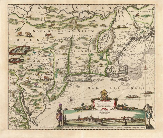
This is one of the most decorative colonial maps of the United States and the last in the Jansson/Visscher series. Geographically and stylishly the map is derived from Visscher's map of circa 1655. It covers the region from Chesapeake Bay to Penobscot Bay and includes the placement of nearly every colonial settlement along the coastline and rivers. The land is fully engraved to show forests, mountains, rivers and lakes with most of the geography based on the work of Champlain. This is the second state, revised to show Philadelphia and to show the new colony of Pennsylvania. The Delaware River was completely redrawn to erase a connection with the Hudson River. An array of domestic animals have been added to the wild animals and Indian village scene. The most important feature of the map is the superb view of New York below the title cartouche that was taken from the Visscher map. In this state the title to this view acknowledges the English hold over the city with Nieuw Yorck, eertys Genaemt above the original title Nieuw Amsterdam op't Eylant Manhattans.
References: Burden #434; McCorkle #680.2; Campbell, Jansson-Visscher #9.
Condition: A
A fine impression with original color that has slightly oxidized and been professionally reinforced on verso.