Subject: Colonial New England and Mid-Atlantic
Period: 1636 (published)
Publication: Appendix Newer Atlas
Color: Hand Color
Size:
19.7 x 15.2 inches
50 x 38.6 cm
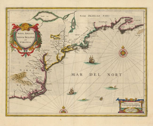
This is the first state of Jansson's important map of the eastern coast of North America covering from just south of Cape Fear to Nova Scotia. The map is based on the less well-known map of Johannes de Laet of 1630, but covers a slightly larger area. Because of its wider distribution, Jansson's map was much more influential, particularly with its depiction of the Dutch of Nieuw Nederland (New York). The map includes part of the Great Lakes, labeled Grand Lac and Lac des Yroquois, an unnamed Lake Champlain, and a fictitious lake at the headwaters of the Delaware River. According to Karpinski, this "is the first printed complete map of Lake Superior" although according to Burden there is no evidence to support that and Grand Lac is more likely Lake Huron. The map is adorned with two decorative cartouches, ships, sea monsters and compass roses. German text on verso.
References: Burden #247; Cumming (SE) #39; Karpinski, p. 26 & 31 plt. II; McCorkle #636.2.
Condition: A
Slight show through of text on verso else very good with a sharp impression.