Subject: Eastern United States
Period: 1835 (dated)
Publication:
Color: Hand Color
Size:
19.5 x 16 inches
49.5 x 40.6 cm
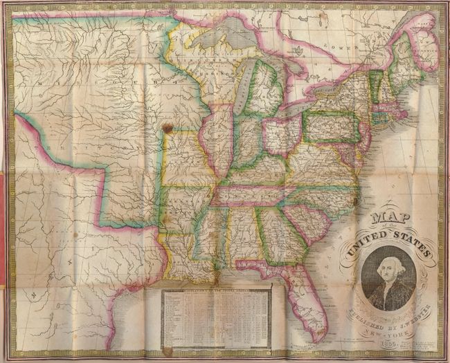
This is a scarce pocket map published by James Webster from Humphrey Phelps' plate of 1832. Phelp's name has been erased and Webster's has been added on the lower right. George Washington's portrait decorates this map along with a chart of the population of the United States in 1830. The map shows a large Missouri Territory reaching from Missouri and stretching to the Rocky Mountains. Wisconsin Territory is massive and includes the Upper Peninsula of Michigan and a portion of Minnesota. Arkansas gained statehood the year this map was published, but it is still shown as a territory. Texas is named and included as part of Mexico. The map folds into original yellow paper covers (3.5 x 5.3"), attaching at back. The folding "Traveller's Guide and Statistical View of the United States" (22 x 17.8") attaches to front cover.
References:
Condition: B+
Map has good color and no physical flaws, but has a few spots including a large spot at upper corner of Missouri. The Statistics sheet is very nice with just a little toning where pasted onto cover. The covers have a little soiling but are very nice.