Subject: Eastern United States, Tennessee, Ohio and Pennsylvania
Period: 1828-1834 (dated)
Publication:
Color: Black & White
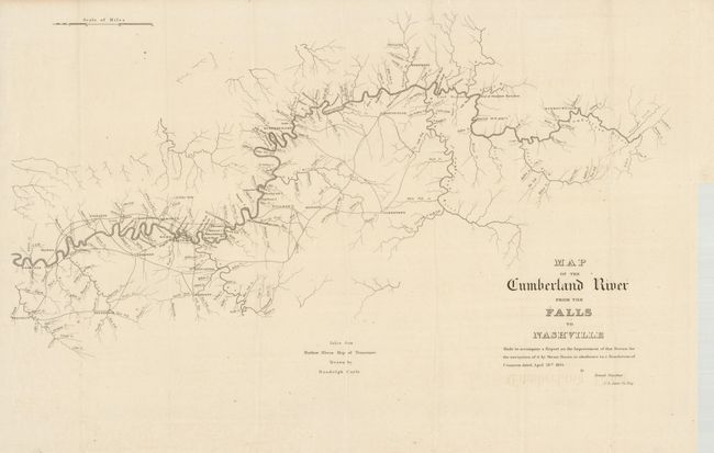
Two scarce maps that accompanied a congressional report from 1834. The first map (28 x 16") follows the course of the Cumberland River to near its source in Kentucky naming Nashville, Rome, Carthage, Williamsburg, Burksville and more along the route. Also locates the towns of Jamestown, Liberty, Monticello and Burkesville as well as noting the head of steamboat navigation just below a 56 foot waterfall. The map has good detail within 30 - 50 miles of the river showing towns, roads and waterways. The geography was taken from Matthew Rhea's Map of Tennessee. It was drawn by Randolph Coyle and was included in Howard Stansbury's report.
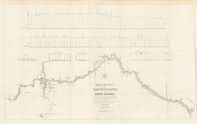
The second map (31 x 18.6") details the P & O Canal naming Akron, Ravenna and Youngstown along its route. This map, dated 1828, precedes the canal's actual opening by twelve years. The title continues "From Akron on the Ohio Canal by the Vallies of the Cuyahoga and Mahoning on the Shenango." It covers the canal from Akron to just inside the Pennsylvania border with detail limited to near the waterway. The canal's elevation profile is along the top. The map was copied by David H. Burr and engraved by J.V.N. Throop after the original map drawn by Lieutenants Dumeste, Farley and Ewing under the direction of Lieut. Col. Kearney.
References:
Condition: A
Folding as issued. Both are clean and bright examples with only minor imperfections.