Subject: Canada & United States, Detroit
Period: 1902-1920 (circa)
Publication:
Color: Printed Color
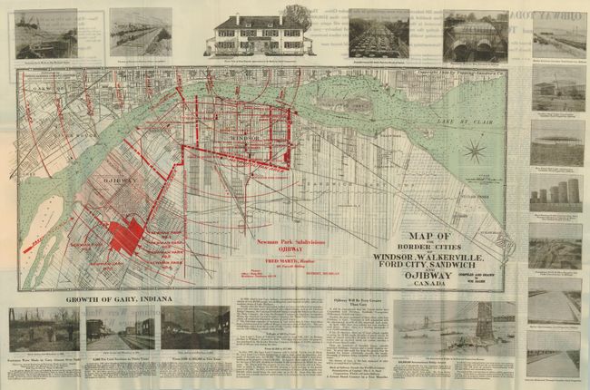
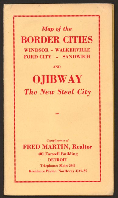
1. Map of the Border Cities of Windsor, Walkerville, Ford City, Sandwich and Ojibway Canada, 28" x 12.5", circa 1920. This is a handsome real estate speculation map showing Detroit and the area across the river. Ojibway was intended to become a major steel center after U.S. Steel purchased a large plot of land. Unfortunately for the speculators, the project was ultimately abandoned. It uses red over printing to show proposed subdivisions. Across the top and at right are images of preliminary construction at the plant plus top center is a beautiful home that is "to be built by Steel Corporation." Below is a promotional article with illustrations titled the "Growth of Gary, Indiana." On the verso is a large plat of the proposed new community "Ojibway Today and Tomorrow," which includes more marketing hype about the future, calling the area the "Gary of Canada." With side panels "Now - While the City is in the Making is the Time to Buy in Ojibway" and "Merger of Border Cities Practically a Certainty." This pocket map folds into original yellow paper covers with "Compliments of Fred Martin, Realtor 401 Farwell Building, Detroit." In case the hapless reader missed the point, Fred ends with "Fortunes Were Made at Gary Indiana, Fortunes Will be Made at Ojibway." Surprisingly, a quick Google search located no record of Fred being strangled by an angry investor. Very fine condition (A+).
2. Plan of the City of Toronto, W.S. Johnston & Co., Toronto, circa 1910, 10" x 21". Advertising map, "Compliments of Holt, Renfrew & Co.," is handsomely printed in yellow, green, brown and black. Advertisement at upper left is a photo of the storefront for Holt, Renfrew & Company, "Furriers to Her Majesty the Queen." Street index on verso with a second, decorative advert for Holt, Renfrew. Folds into tan paper covers (3.6" x 6") green lettering. Short tear at paste-down side, still very good. (A)
3. Ontario, Rand, McNally, Chicago, 1902, 26.6" x 19". This highly detailed map is filled with information. Red overprinted table identifies 22 railroads. Four inset maps: Western Portion of Ontario; Toronto and Environs; Ottawa and Environs; River St. Mary and Environs. The map has an index of Chief Cities at left and a blank verso. Folds into tan paper covers (4" x 6.6") with the title, "Rand, McNally & Co's Index Pocket Map and Shipper Guide of Ontario…" The 42 pp Shipper guide includes advertisements. The map is fine, but covers split cleanly at spine. (A)
4. New Brunswick, Nova Scotia and Prince Edward Island (The Maritime Provinces of Canada), Rand, McNally, Chicago, 1906, 19" x 13.5". Another highly detailed pocket map by the Rand, McNally company. Index to Chief Cities along bottom. Blank verso. Folds into tan paper covers (4" x 6.6") with the title, "Rand, McNally & Co's Index Pocket Map and Shipper Guide of Nova Scotia, New Brunswick, and Prince Edward Island…" 20 pp booklet. The map, cover and booklet are fine (A+).
References:
Condition:
See individual descriptions.