Subject: United States & Canada
Period: 1887 (dated)
Publication:
Color: Printed Color
Size:
53 x 38 inches
134.6 x 96.5 cm
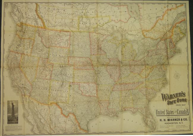
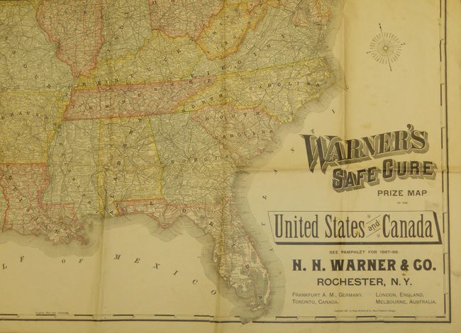
This huge, folding map of the United States and southern Canada is an very uncommon map promoting a patent medicine company. The large illustration at the bottom left of the Statue of Liberty, Liberty Enlightening the World, includes a two-paragraph description of the statue and its construction. The people of France presented the Statue of Liberty to the people of the United States in 1886, the year prior to this map's publication. H. H. Warner Co. was a prolific advertiser and producer of different patent medicines. Warner's Safe Cure was a preparation that was marketed as a cure-all for diseases and problems relating to the kidneys and liver. The map is typical of Rand McNally's maps of the late nineteenth century, showing each state with counties delineated, roads, cities and terrific detail on the railroad system. With limited topography and watershed information.
References:
Condition: B+
The map is folding as issued. The maps has been stabilized with some folds and fold intersections reinforced on verso. A couple small areas of soiling or foxing that do not detract from a very large map.