Subject: Canada & United States, Texas
Period: 1840 (dated)
Publication: Atlas Universel de Geographie Physique, Politique et Historique…
Color: Hand Color
Size:
20.3 x 14.5 inches
51.6 x 36.8 cm
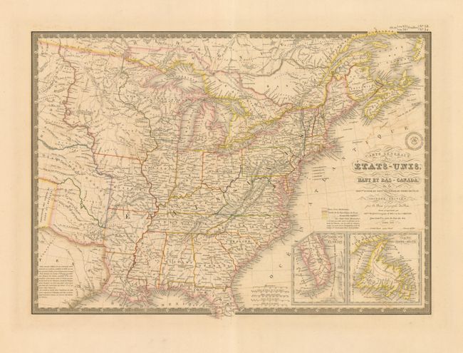
An uncommon and finely engraved map covering all the eastern United States to about the 100th meridian, including a little of southern Canada. The western territories include Ter. du Nord Ouest that encompasses present-day Wisconsin, the Upper Peninsula of Michigan, and Minnesota. The rest of the west beyond Missouri and Arkansas is designated as Indian Districts/i>. The eastern half of the Republic of Texas is shown but is mostly blank with a lengthy notation filling the central portion. Insets of the tip of Florida and Newfoundland are located in the lower right. Surrounded by a decorative keyboard-style border that indicates longitude from Paris. The handsome map includes fancy title lettering embellished with flourishes and Brue's embossed seal.
References:
Condition: B+
Very crisp impression and original hand coloring on a thick sheet with very wide margins. Some light offsetting visible in the blank Atlantic.