Subject: North America
Period: 1854 (dated)
Publication:
Color: Hand Color
Size:
13.8 x 18.2 inches
35.1 x 46.2 cm
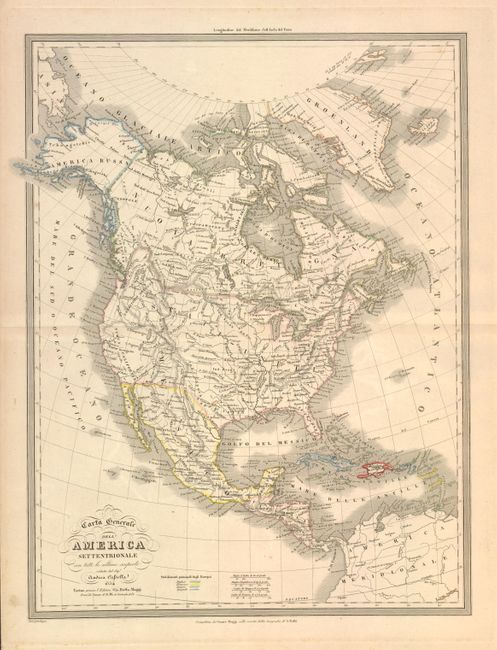
This rare Italian map was drawn by Andrea Cassella, compiled by Caesar Maggi and published by Adriano Balbi. Clearly dated 1854, the map nonetheless names the Rep. di Texas and also shows the boundary between Canada and the United States in a pre-1848 configuration with a portion of the Territorio Oregone extending well into southwestern Canada. The mapping of the Great Basin is fairly accurate and suggests Fremont's discoveries of the 1840s were incorporated in this map. Good detail of Indian tribes, watershed and topography in the west. The Mexican/US boundary is post-Mexican/American War but does not include the Gadsden Purchase of 1853/54. Alaska is named America Russa. Colonial possessions in the West Indies are outlined in color, keyed to the legend located at lower left between the fancy titling and the four distance scales.
References:
Condition: A
Dark impression and original color on thick paper with wide margins.