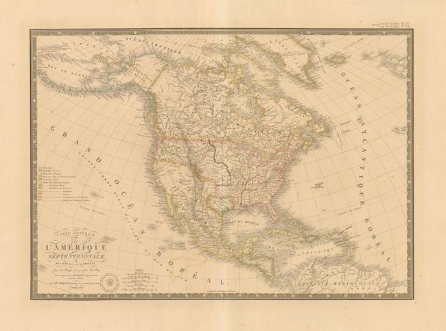
Subject: North America, Texas
Period: 1840 (dated)
Publication: Atlas Universel de Geographie Physique, Politique et Historique…
Color: Hand Color
Size:
20.3 x 14.3 inches
51.6 x 36.3 cm
This excellent map of North America and the West Indies features the Independent Republic of Texas. It is beautifully engraved and printed on fine heavy paper. Alaska is Amerique Russe and is still a bit misshapen. The individual state and territorial borders are shown up to the Mississippi River, with the large Arkansas Territory extending over the top of eastern Texas. The legend identifies, via color, twelve different countries including the colonial holdings of France, England, Spain, Denmark, Holland, and Sweden and there are five distance scales. The handsome map includes fancy title lettering embellished with flourishes, Brue's embossed seal and a decorative keyboard-style border.
References:
Condition: B+
Very nice example with fine original hand coloring and lovely impression on a thick sheet with very wide margins. A little offsetting in blank ocean.