Subject: Sumatra, Indonesia
Period: 1750 (circa)
Publication: L'Histoire Generale des Voyages
Color: Black & White
Size:
11.4 x 9.7 inches
29 x 24.6 cm
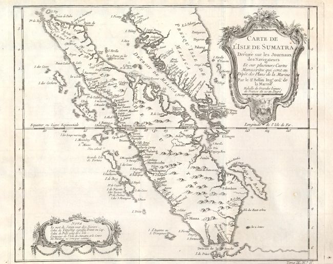
This finely engraved copper-plate chart shows all of Sumatra and the southern portion of the Malaysian peninsula. Singapore is not identified, but several other lesser islands are named including Tioman Island, Banca, and Penang, plus many off the west coast of Sumatra. Good detail of the Straits of Malacca and the Detroit de Sincapour. The cities of Palembang, Jambi, Manimcabo, Aceh and Batang are located, but not Medan. Decorative French rococo-style cartouches contain the title and a second one at lower left for notes. At lower right below neatline is "Tome IX. No. 6."
References:
Condition: B+
The map image is fine, but there is some roughness to the edge of the paper in lower margin, outside of the map image. Beautiful, dark impression.