Catalog Archive
Auction 133, Lot 618

"Carta Accurata dell'Imperio del Giappone", Tirion/Albrizzi
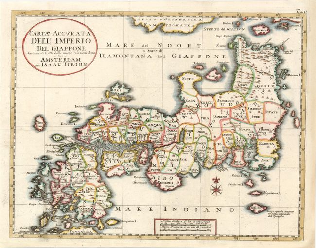
Subject: Japan

Period: 1738 (published)

Publication: Lo Stato Presente di Tutti…

Color: Hand Color

Size:
12.8 x 9.8 inches
32.5 x 24.9 cm
Download High Resolution Image
(or just click on image to launch the Zoom viewer)

Albrizzi published this Italian version of Tirion's first map of Japan. In the upper part of the map Jesso of Jesogasima Kamtzchatka is shown north of the Noto Peninsula. At the map's lower edge, the tip of the island of Ryukyu is labeled Tanaxima. The route of the Dutch expedition between Nagasaki and Edo is shown. This version of the Kaempfer/Scheuchzer type map served as a model for the miniature maps in Kaempfer's later editions.

References: Walter #OAG-81.

Condition: A

Expertly remargined at right.

Estimate: $550 - $750

Unsold

Closed on 9/1/2010

Archived