Subject: Tibet
Period: 1735-1883
Publication:
Color:
Nice collection covering Tibet and adjacent parts of Asia.
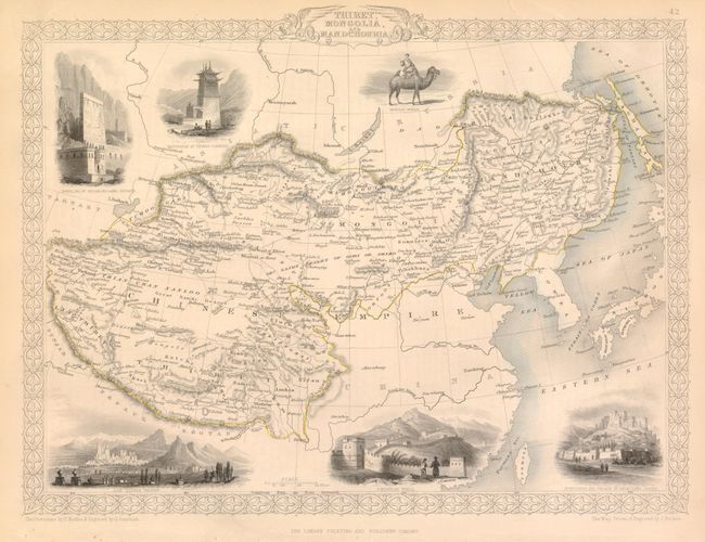
1) Thibet, Mongolia, and Mandchouria, by J. Tallis, from Illustrated Atlas and Modern History of the World, circa 1851, hand color, (13 x 9.8"). A fine steel engraved map with six vignettes and decorative borders. Covers the region from Tibet through northwestern China to Manchuria. Includes vignettes of the Fortress and Palace of Dalai Lama at Lassa, the Chinese Wall, Leh in Little Thibet and others. Original color is a bit faded (B+).
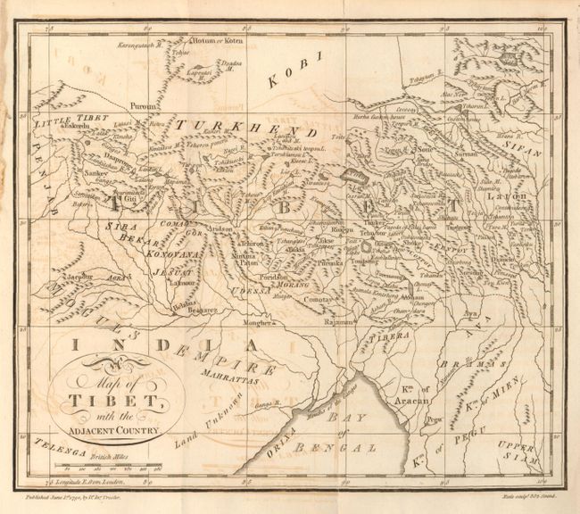
2) Map of Tibet, with the Adjacent Country, engraved by Neele and published by J. Trusler, 1790, black & white, (8.8 x 7.4"). Issued folded with some minor offsetting (B+)
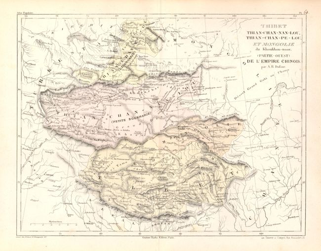
3) Thibet Thian-Chan-Nan-Lou, Thian-Chan-Pe-Lou, et Mongolie du Khoukhou-noor, (Partie-Ouest) de l'Empire Chinois, by A.H. Dufour, circa 1840, hand color, (12.5 x 9.5"). Original color (A+).
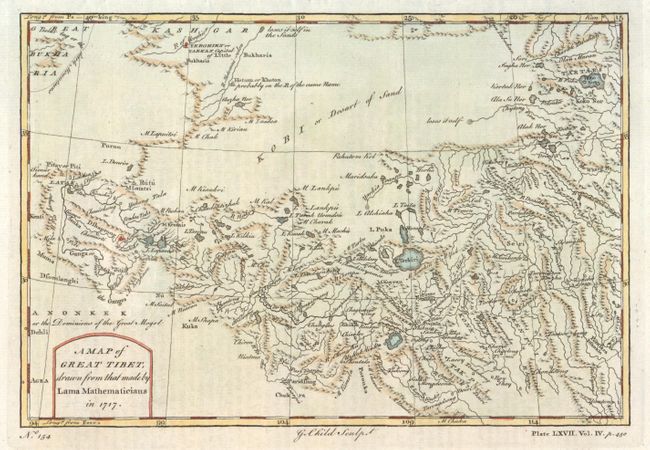
4) A Map of Great Tibet, drawn from that made by Lama Mathematicians in 1717, by G. Child, circa 1750, hand color, (9 x 6"). (A)
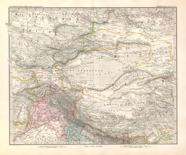
5) Indien & Inner-Asien - Nordliches blatt No. 64, by J. Perthes, from Stieler's Hand-Atlas, 1883, hand color, (16 x 13"). (A+)
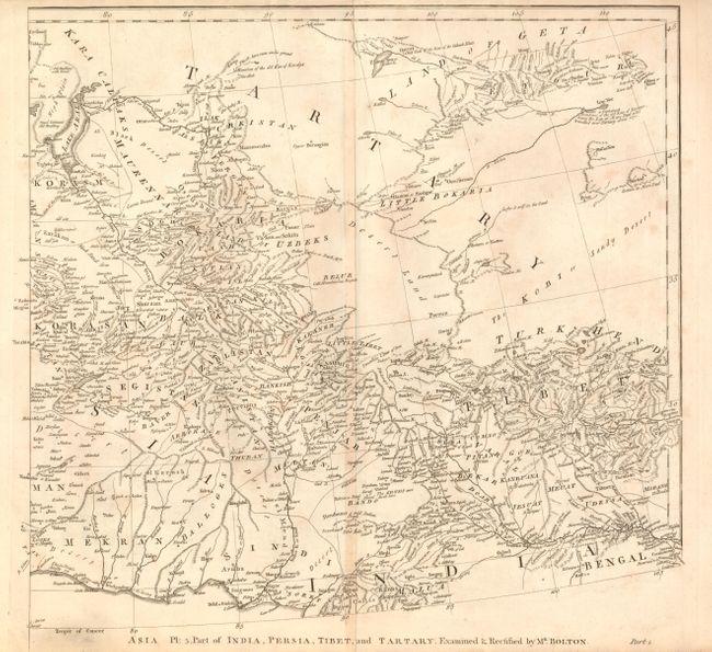
6) Asia Pl: 5. Part of India, Persia, Tibet, and Tartary. Examined & Rectified by Mr. Bolton by S. Bolton, circa 1745, black & white, (16.5 x 15.5"). Minor toning (B+)
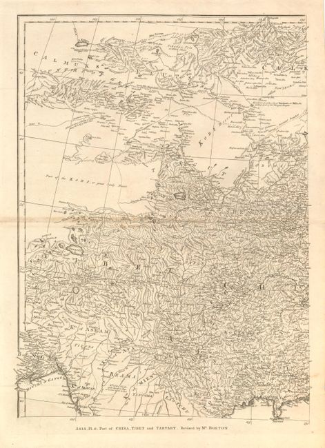
7) Asia Pl: 6. Part of China, Tibet, and Tartary. Revised by Mr. Bolton by S. Bolton, circa 1745, black & white, (13.8 x 18.5"). Minor toning along centerfold (B+)
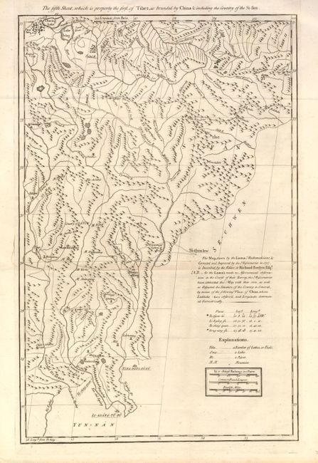
8) The fifth Sheet, which is properly the first, of Tibet, as bounded by China & including the Country of the Si-fan., by D'Anville, from Du Halde's Description Geographique, Historique ... et Physique de la Chine ....circa 1735, black & white, (12.5 x 19.2"). The maps from Du Halde's atlas were assembled by D'Anville and compiled from an extensive Jesuit survey carried out in 1717. The missionaries used local sources and personal observation to prepare these incredibly detailed maps. (A)
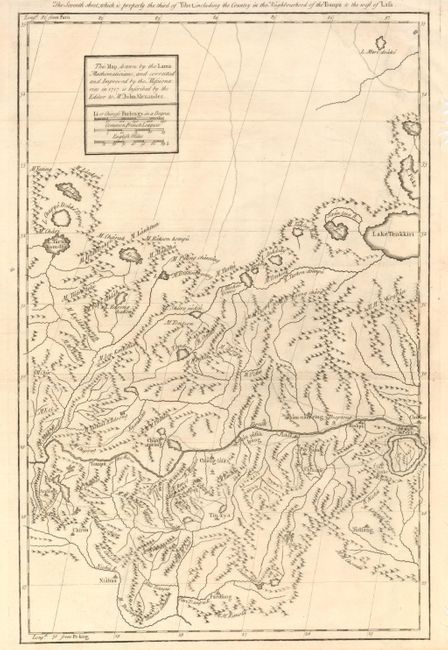
9) The Seventh sheet, which is properly the third of Tibet, including the Country in the Neighborhood of the Tsanpu to the west of Lasa., by D'Anville, from Du Halde's Description Geographique, Historique ... et Physique de la Chine ....circa 1735, black & white, (12.5 x 19.2"). There are significant worming in the right margin, not affecting the map (A).
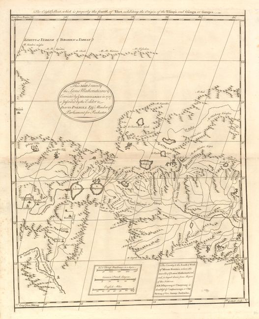
10) The Eighth Sheet, which is properly the fourth, of Tibet, exhibiting the Origin of the Tsanpu and Ganga or Ganges., by D'Anville, from Du Halde's Description Geographique, Historique ... et Physique de la Chine ....circa 1735, black & white, (12.5 x 15.4"). There is some worming in the right margin, not affecting the map and a bit of minor foxing (B+)
References:
Condition:
See individual descriptions.