Catalog Archive
Auction 133, Lot 550

"Carte pour Conduire a l'Inteligence de l'Histoire Sacree, qui Renferme en Abrege … Quatrieme Periode du Monde…", Chatelain, Henry Abraham

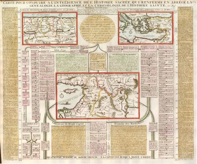
Subject: Middle East and Eastern Mediterranean

Period: 1720 (circa)

Publication: Atlas Historique…

Color: Hand Color

Size:
18.8 x 15.5 inches
47.8 x 39.4 cm
Download High Resolution Image
(or just click on image to launch the Zoom viewer)

Intriguing folio sheet with three maps of the Holy Land with text and family trees describing the region during biblical times. At upper left a map of Palestine is divided into Galilee, Samaria, and Judea as traveled through by Jesus Christ. At upper right a map of the Eastern Mediterranean illustrates the travels of the Apostles. And at center is a map of the Middle East for the understanding of the history of the Kings. The balance of the sheet is comprised of genealogical diagrams and historical text.

References: Laor #212.

Condition: A

There is a bit of minor toning in the top margin.

Estimate: $200 - $250

Sold for: $190

Closed on 9/1/2010

Archived