Catalog Archive
Auction 133, Lot 539

"Gibraltar avec les Nouveaux Ouvrages Faites depuis le Dernier Siege. Les Lignes Espagnoles Leve Nouvellment sur les Lieux [on sheet with] Plan du Port et Ville de Mahon, du Fort St. Phillippe et ses Fortifications", Le Rouge, George Louis

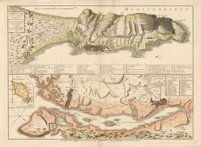
Subject: Western Mediterranean, Balearic Islands & Gibraltar

Period: 1756 (dated)

Publication:

Color: Hand Color

Size:
26.2 x 18.8 inches
66.5 x 47.8 cm
Download High Resolution Image
(or just click on image to launch the Zoom viewer)

This is a superb map of two important British possessions in the Mediterranean - Gibraltar and Mahon Harbor on Minorca. The European wars of the eighteenth century brought heightened interest in detailed mapping of the strategic harbors and fortifications in the Mediterranean. The map provides a detailed view of the fortifications with extensive keys. The British gained control of Minorca and Gibraltar during the War of the Spanish Succession. This map was published at the outbreak of the Seven Years War, when the French gained control of Port Mahon and Fort St. Philippe.

References: MapForum Online Issue #8-43

Condition: A

There is a minor crease to the right of the upper centerfold and some light surface soil.

Estimate: $800 - $950

Sold for: $600

Closed on 9/1/2010

Archived