Subject: Brazil
Period: 1671 (published)
Publication: America
Color: Hand Color
Size:
13.8 x 11.3 inches
35.1 x 28.7 cm
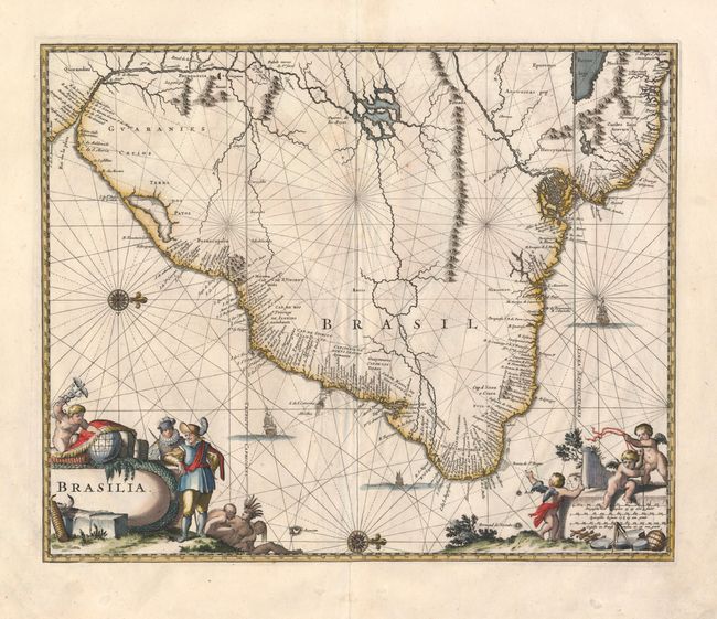
Excellent map of the eastern part of Brazil based on the cartography of Hessel Gerritsz and an earlier map by Blaeu. Extensive detail in coastal regions with the interior left largely blank except for some conjectural river systems. The Linea Aequinoctialis is prominently shown dividing the Spanish and Portuguese colonial claims. Richly embellished with rhumb lines, compass roses and sailing ships. European traders, Indians and putti surround the title and scale of miles cartouches.
References:
Condition: B+
Nice impression with some faint damp stains and some roughness at paper edges, well away from the map.