Subject: Panama and Northern South America
Period: 1850-57 (published)
Publication: Illustrated Atlas and Modern History of the World
Color: Hand Color
The maps from The Illustrated Atlas were first published in serial form to a target audience that led insular lives due to the expense and hardship of travel. All that changed as the progress of the nineteenth century brought swift and dramatic changes in public awareness of far away places. Tallis' maps no doubt played an important role in this dramatic awakening. These maps not only provided up-to-date geographical knowledge, but also used vignette views within the map's design to show the native people and their occupations, cities and points of interest. The maps hark back to a cartographic tradition from the Dutch mapmakers of the seventeenth century with finely engraved decorative borders. The maps were drawn and engraved by John Rapkin with views drawn and engraved by a number of prominent artists. The maps were issued as a complete volume from 1851 until about 1865. Some of the maps were also published in other history books published by Tallis including British Colonies and, without the vignettes, in geographical dictionaries and encyclopedias until about 1880.
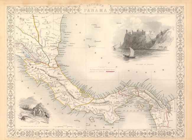
1. Isthmus of Panama, (13 x 10"). Lovely map of the region from Nicaragua through Panama. There are three proposed canals and roads shown; two in Panama, and another in Nicaragua, but none follow the canal eventually built. The map is ornamented with two steel-engraved vignettes: The Fort at Chagres and Gold Seekers on their way over the Cordilleras, both designed and engraved by H. Warren and J. Wrightson respectively. With marginal toning from old framing. (B+)
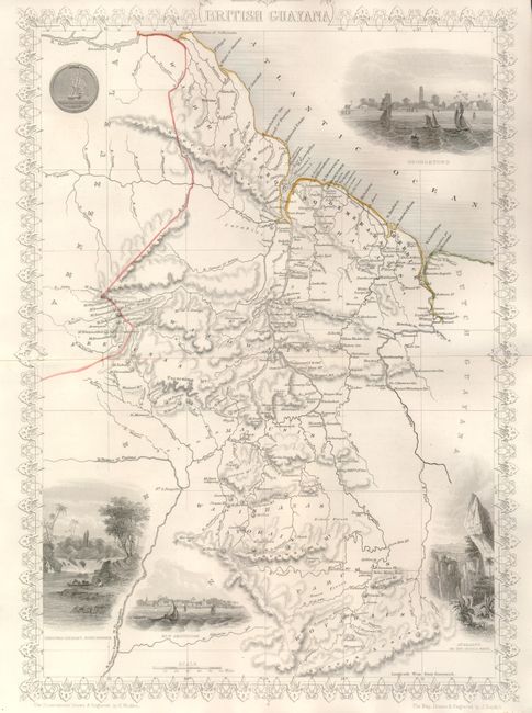
2. British Guyana, (9.8 x 13.4"). Includes the national seal and vignettes of Georgetown, Ataraipu or the Devil's Rock, New Amsterdam, and Christmas Cataract, River Berbice. With related text sheet. Age toned in margins. (A)
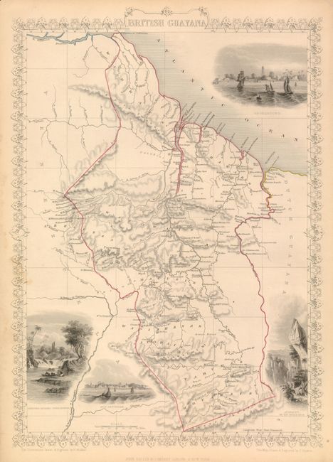
3. Another example of British Guyana, 1857, (9.8 x 13.4"). The map image is fine, but trimmed just to upper decorative border above title. (A)
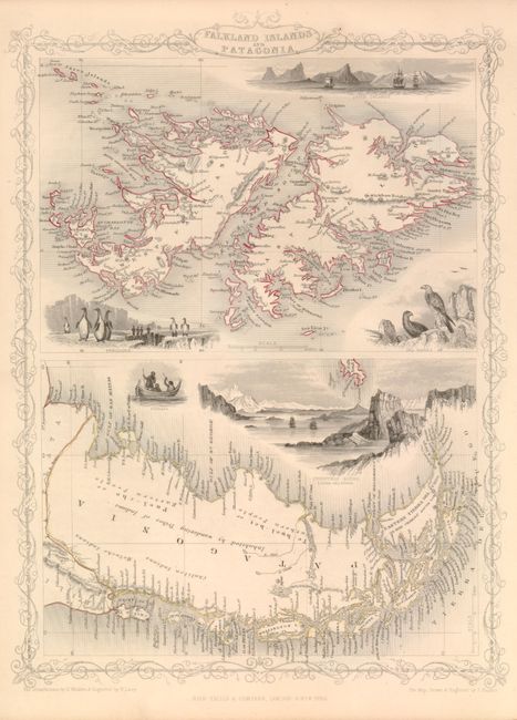
4. Falkland Islands and Patagonia, (10 x 13.2" ). Two maps within one decorative border. The map of the Falklands is very detailed and is surrounded by finely rendered engravings of penguins, sea birds and tall sailing ships anchored off Jason Island. The map of Patagonia has good detail along coastline, but little in the interior. It has a large vignette of Christmas Sound in Tierra del Fuego with clippers under sail plus a small vignette of Fugeans in a boat. With sheet of text. Near fine. (A)
References: Map #1 - Kapp (MCC-73) #116.
Condition:
See individual descriptions. All with original hand color.