Subject: Oregon
Period: 1876 (dated)
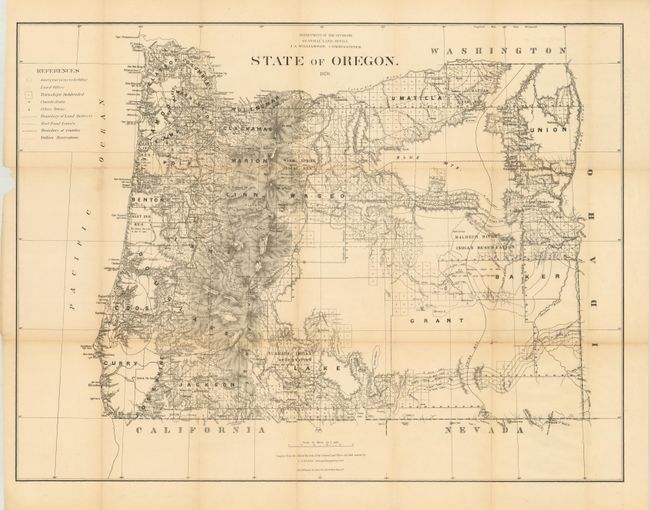
Publication: Dept. of the Interior
Color: Black & White
Size:
31.5 x 23.8 inches
80 x 60.5 cm
This map is the same size but pre-dates the printed color maps issued in the 1880s. It was compiled from official records in the GLO and other sources by C. Roeser, Principal Draughtsman, J.A. Williamson, Commissioner. Excellent detail from the Cascade Mountains west to the coast notes all towns and villages, roads, and railroads, with watershed and topography shown in bold hachure. The legend identifies Indian reservations, railroad limits and townships subdivided. The granted and indemnity limits of military wagon roads are illustrated. Lithography and printing by Julius Bien in New York City. Blank verso.
References:
Condition: B+
One inch portion of left margin missing, just touches neatline. A little fold toning and weakness at two fold intersections, and some archival tissue along some folds.