Subject: Oklahoma
Period: 1885 (circa)
Publication:
Color: Printed Color
Size:
22 x 15 inches
55.9 x 38.1 cm
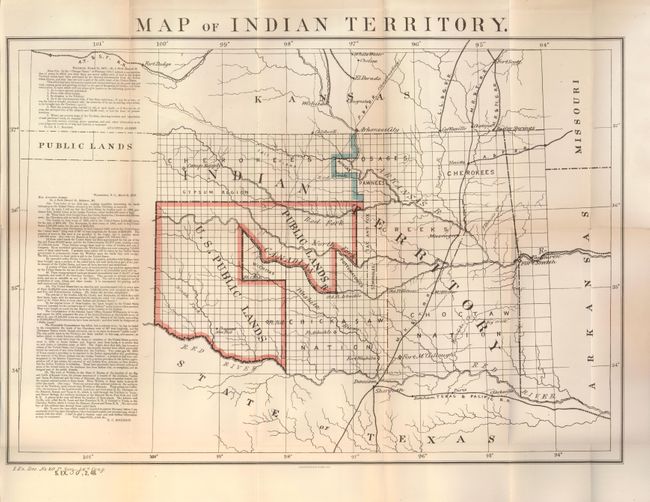
An uncommon edition of this map published for a second time for the 48th Congress. Dated 1879 with the original publishing credit for the 46th Congress overprinted with "S. Ex. 50, 48th Congress, 2nd Session" for this later, 1885, version. It is a desirable map that depicts the territory with the first designation of Public Lands. Included in a panel to the side of the map are two fascinating letters concerning the disposition of the Public Lands within the territory. The first, by Congressman Augustus Albert contains a list of questions. The answers, by Col. E.C. Boudinot, attempts to "set the records straight" by detailing how the land was acquired from the Indians, its current status, and directions to "several million acres of the richest land on the continent." A number of army forts are named and located. The map is a significant and important map for any Oklahoma collection.
References:
Condition: A
Very nice example with very light toning at one fold which has a paper repair on verso. Full margins and very good color. Folded as issued.