Subject: New York City
Period: 1870 (dated)
Publication:
Color: Hand Color
Size:
17.3 x 23 inches
43.9 x 58.4 cm
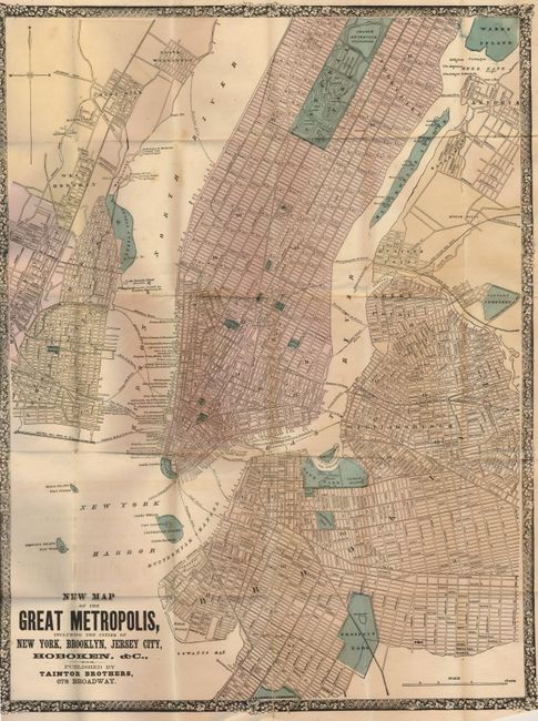
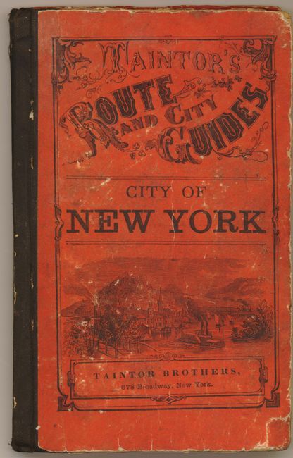
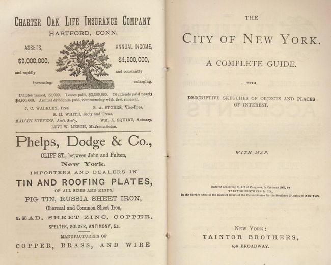
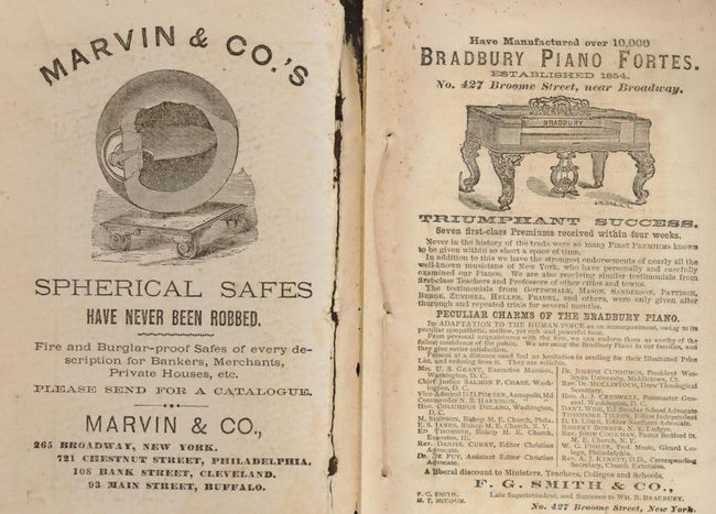
This uncommon pocket map folds into original 8vo boards. The map details Manhattan up to 105th Street to include most of Central Park. The map is pre-Brooklyn Bridge so only ferry routes are noted . All streets are located and named as are all steamship and liner wharfs including the Havana & New Orleans, California via Panama, California via Nicaragua, the Neptune Line and many more. Locates parks, reservoirs and the Hudson River RR. The map extends to include Jersey City, Astoria, Williamsburg, Brooklyn, etc. Surrounded by an heavy block-printed border with a grapevine motif. Folds into orange pictorial hard paper covers (4.2" x 6.5") with fancy title and an image of a steamer. The cover is titled "Taintor's Route and City Guides. City of New York." Inside front cover is paper label advertisement for Marvin & Companies Spherical Safes which "have never been robbed." The 70pp tourist booklet "The City of New York. A Complete Guide with Descriptive Sketches of Objects and Places of Interest. With Map" includes several un-numbered pages of advertisements including the Cosmopolitan Hotel "On the European Plan" and two additional adverts by safe companies: Valentine and Butler, and the Steam and Fire-Proof "Sanborn's Patent" safes by American Steam-safe company.
References:
Condition: B+
A fold split in one panel a bottom and slight offsetting from darkly inked title.