Subject: Boston, Massachusetts
Period: 1855-1873 (dated)
Publication:
Color: Hand Color
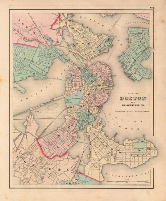
This pair of maps provide an interesting study of the development and land reclamation efforts in Boston between the 1850's and 1873.
The earlier example is Map of Boston and Adjacent Cities, by J.H. Colton, 1855, (12.7 x 14.5"). From the General Atlas this handsome map shows the city prior to filling in the Back Bay. In this area the planned streets and improvements are suggested by faintly engraved lines. Extends to include South Boston, Roxbury, Cambridge, Somerville, Charlestown, and East Boston. Names at least seven railroads and four bridges.
The later example is Map of the Compact Portions of Boston and Adjacent Cities, from Gray's 1873 Atlas of the United States…, (12.3 x 15.3"). Here Back Bay is completely filled in with all streets named. The map shows more railroads and bridges.
References:
Condition: A
The Colton map has a few diffuse, light foxing spots otherwise very good. The Gray is very good. Both with full margins and original hand coloring.