Subject: District of Columbia
Period: 1901 (dated)
Publication:
Color: Printed Color
This set of maps were created as part of a plan to enlarge and improve the Park System in the Capital. The first three are drawn on the same base map but details a different aspect of the plans. The final map appears identical but is in fact larger.
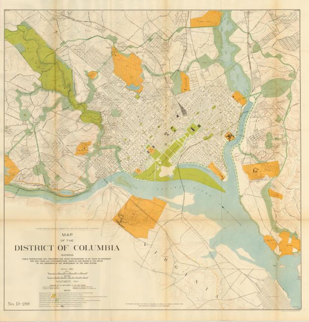
1) Map of the District of Columbia Showing Public Reservations and Possessions and Areas Recommended…for New Parks…, (26.5 x 26.6").
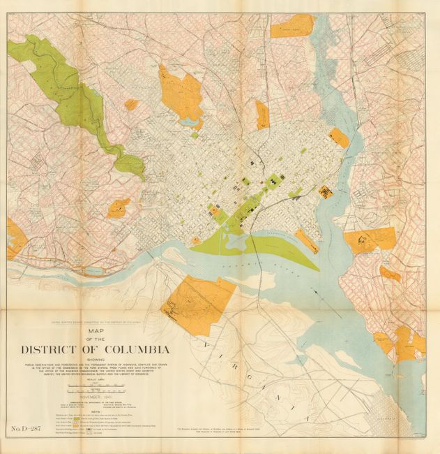
2) Map of the District of Columbia Showing Public Reservations and the Permanent System of Highways, (26.5 x 26.6").
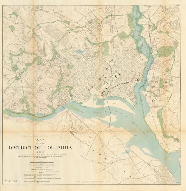
3) Map of the District of Columbia Showing Areas Recommended…for New Parks…, (26.5 x 26.6").
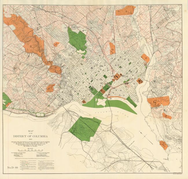
4) Map of the District of Columbia 1901… For the Preparation of a Plan for the Improvement of the Park System of the District of Columbia., (28 x 26.4"). This large and colorful plan depicts current park areas, proposed street development plan, topography and schools. This ambitious map is replete with information including the Permanent System of Highways and Authorized New Railroad Locations. Twenty different areas name their controlling agency including the War Department, Navy, Interior Dept., Smithsonian, and more. It extends to show a corner of Alexandria in the south, and in the north some or all of Kenilworth, Burrville, Woodridge and Takoma, west to American University Park, and east about two miles past the Anocostia River. Numbered "No. D-99" at lower left. North is oriented to the upper left. Prepared by J.G. Langdon and printed by A. Hoen & Co. of Baltimore.
References:
Condition: B+
Each is a fine impression with full original margins. Folded as issued. A little light occasional fold toning.