Subject: California - Yosemite Park
Period: 1896-1916 (dated)
Publication:
Color: Black & White
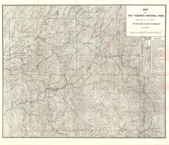
1) Map of the Yosemite National Park Prepared for Use of U.S. Troops by N.F. McClure, 1st Lieut., 5th Cavalry, Norris Peters Co., Washington D.C., 1896. (19.8 x 16.3"). This very detailed and important map was made shortly after the establishment of Yosemite as a protected park in 1890. During this period, the Army's Fifth Cavalry Regiment controlled the park, and this was made for their use. The map is filled with information on trails, cabins, camps and meticulous notes on topography. Prepared by N.F. McClure, 1st Lieut., 5th Cavalry. (A+)
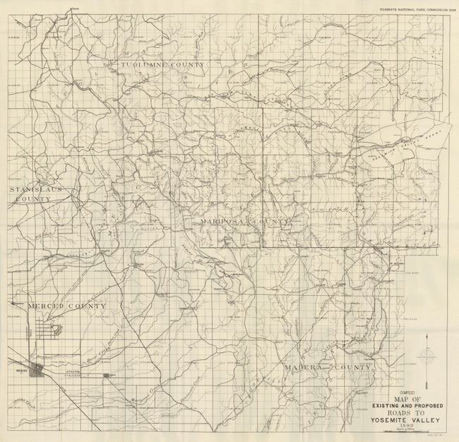
2) Compiled Map of Existing and Proposed Roads to Yosemite Valley,by Yosemite National Park Commission, 1899, (32 x 30.2"). Very detailed topographical map of the region published as Senate Doc 155, 56th Congress 1st Session. Yosemite Valley is in the upper right with the map extending to Merced, shown in a grid pattern, at lower left. Locates Crocker's PO, Grub Gulch, Coarse Gold PO, Miami, Gambetta Mine, Ferguson's Hotel, Coulterville, LaGrange, Amsterdam and many more. (A+)
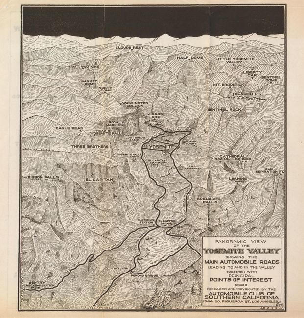
3) Panoramic View of the Yosemite Valley Showing the Main Automobile Roads Leading To and In the Valley Together with Principal Points of Interest,
by Automobile Club of Southern California, 1916, (9 x 10.3"). Very early map by the auto club of Southern California which details the roads and identifies over twenty geographical sites including Bridalveil Falls, El Capitan, the Three Brothers and North Dome. Access to the park is noted from Stockton or Coulterville. Dated 8/16 1916. Beautiful dark impression with short fold split at top. (A)
References:
Condition:
See individual descriptions.