Subject: Southwestern United States
Period: 1851 (dated)
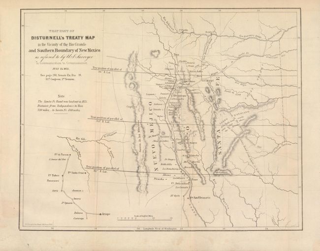
Publication: Senate Ex Doc. 19, 32rd Cong., 1st Session
Color: Black & White
Size:
11 x 8.7 inches
27.9 x 22.1 cm
This is a fascinating map centered roughly on Santa Fe. The map covers the area from the Arkansas River south to the 31st parallel and locates Albuquerque and Tucson. The parallels were being corrected from an incorrect position previously mapped, and this map illustrates both old and new parallels. Shows topography, hydrology, Gen. Kearny's route, the route of the Santa Fe Expedition, the old Spanish military road, among other interesting items. It was one of the key maps in the Bartlett correspondence regarding the dispute over the survey of the Mexican border.
References: Koepp CIS 626, map #4; Wheat (TMW) 720.
Condition: B+
Dark impression and original margins, with a little light toning.