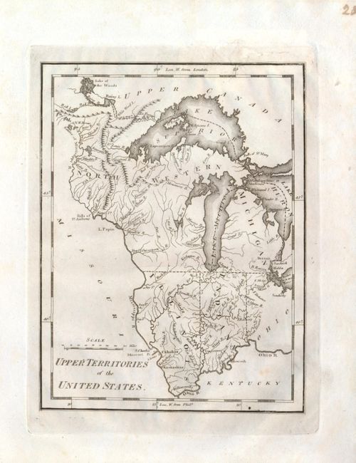
Subject: United States - Midwest
Period: 1814 (circa)
Publication: American Pocket Atlas
Color: Black & White
Size:
5.8 x 7.6 inches
14.7 x 19.3 cm
This map focuses on Ohio, Michigan, Indiana, Illinois and the Northwestern Territory. It shows Chicago in the Northwestern Territory, as the northern Illinois border is shown south of the present-day boundary. The spurious Phillipeaux Island still persists in Lake Superior. Excellent detail of the Mississippi River and above to the Lake of the Woods. Detroit is shown with its Canadian neighbor, Windsor named Sandwich.
References: Karpinski, p. 211, #21.
Condition: B+
The map is a beautiful, dark impression and fine plate mark. An old puncture above upper neatline has two tears that enter border, well closed with old paper repair on verso. Full margins.